- Clothes and footwear

- All in the category Clothes and footwear
- Footwear

- Jackets, coats

- Blouses

- Trousers

- Sweatshirts

- Shirts

- T-shirts

- Shorts, Bermuda shorts

- Functional clothing

- Overalls

- Hats and headgear

- Gloves

- Socks

- Belts

- Suspenders

- Scarves, Bandanas, Barracuda Scarves

- Raincoats, ponchos

- Women's clothes

- Children's clothing

- Clothing maintenance

- Patches, insignias

- Camping and hiking

- All in the category Camping and hiking
- Backpacks

- Bags

- Sleeping outside

- Cookers, grills

- Lighting a fire

- Dishes, tableware

- Hiking food

- Survival kits

- Compasses

- Flashlights

- Camping furniture

- Eye-glasses

- Binoculars, optics, lasers

- Hydration

- Water purification

- Small equipment and small items for survival

- Electronics and accessories for mobile phones

- Watches

- Pouches, holsters

- Paracords

- Wallets

- Towels

- Solar showers

- Waterproof notebooks

- Mosquito and insect protection

- Heaters

- Repair kits and fixing tapes

- Boating equipment

- Health and protection

- Tactical gear

- All in the category Tactical gear
- Plate carriers and accessories

- Load-bearing harnesses

- Tactical vests

- Tactical holsters and pockets

- Ballistic protection

- Hearing protection

- Protection

- Tactical and military backpacks

- Tactical and combat belts

- Tactical Eyewear

- Tactical flashlights

- Helmets, coverage

- Camouflage

- Gas masks and protective equipment

- Medical equipment

- Transport trunks, boxes

- Gunner's supplies

- Knives and tools

- Self-defence

- Guns and ammunition

- Other

Types of clouds
There is no cloud like a cloud and to know them is a basis for a successful weather forecast. In this article we will reveal the types of clouds you should know if you want to do some weather forecast too in the future.
How do clouds form ?
What do we see in the sky, that is actually condensed water or ice crystals. Clouds form when the invisible water vapor in the air condenses into visible water droplets or ice crystals.
How does that happen ? The water vapour condenses to form tiny water droplets. These droplets are so small that they stay suspended in the air. When air rises, it cools, and as the air cools, it becomes saturated and the water vapour in it condenses.
Clouds classification according to height
No cloud will ever be the same. That´s for sure. You also already know, that clouds are formed in different heights and meteorologists classified them according to this:
- High clouds: occurs in about 5 -7 km
- Middle clouds: 2 - 7 km
- Low clouds: 0 - 2 km
- Great vertical extent clouds: storm clouds - they rise to dramatic heights
Now we know how the clouds are formed so let´s reveal the specific types of clouds.
Cumulus
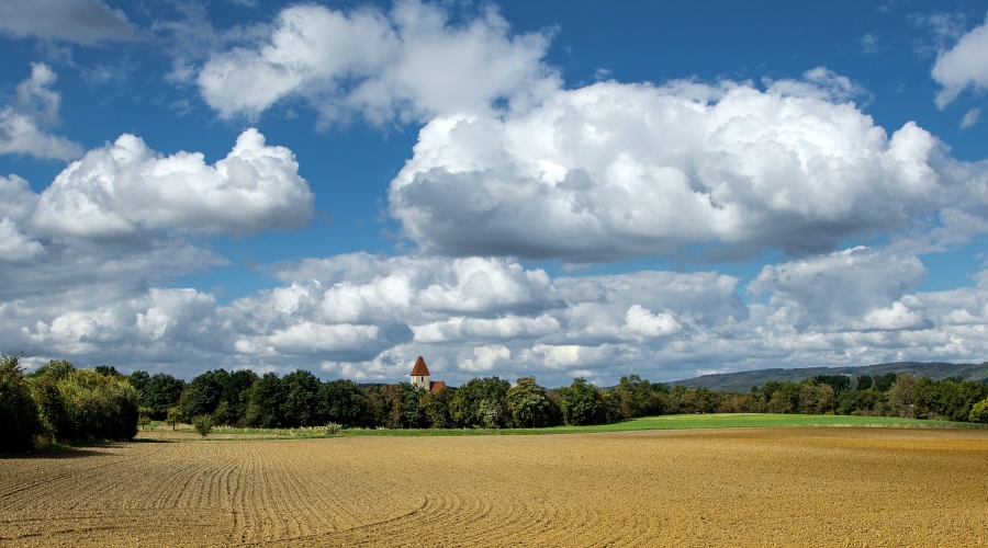
Cumulus clouds are low clouds. They are sometimes called "fair-weather" clouds. They usually predict stable and nice weather. The base is often dark and the top of the cloud has rounded towers and can remind of pieces of floating cotton.
Stratus
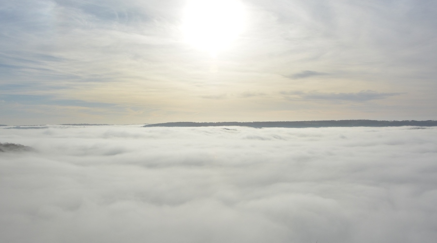
stratus clouds
Stratus are also low clouds, often called mists or fog. Liquid water composition that produces light drizzle which can be prolonged.
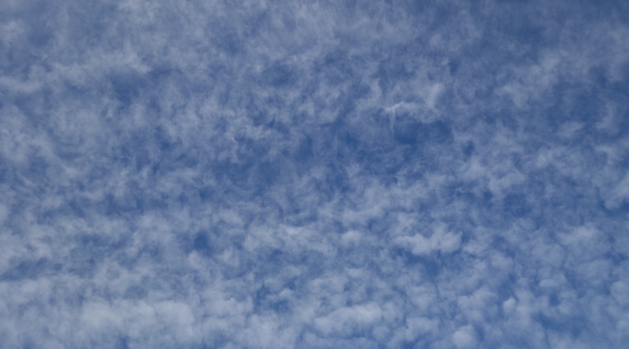
Stratocumulus
Stratocumulus is a low cloud that occurs in patches or layers, composed of rounded masses or rolls. the colour is usually grey or whitish.
Nimbostratus
Nimbostratus is a cloud that no one likes. These clouds are known as "rain clouds", hiding Sun and Moon and produce rain and snow which is usually steady and prolonged.


Altocumulus
The colour of this cloud is greyish or whitish and form very differently, most often rolls, from small clouds to large stratocumulus clouds. Mid-level formation and some altocumulus clouds may indicate rapid change of weather accompanied for example by storm.
Cirrus
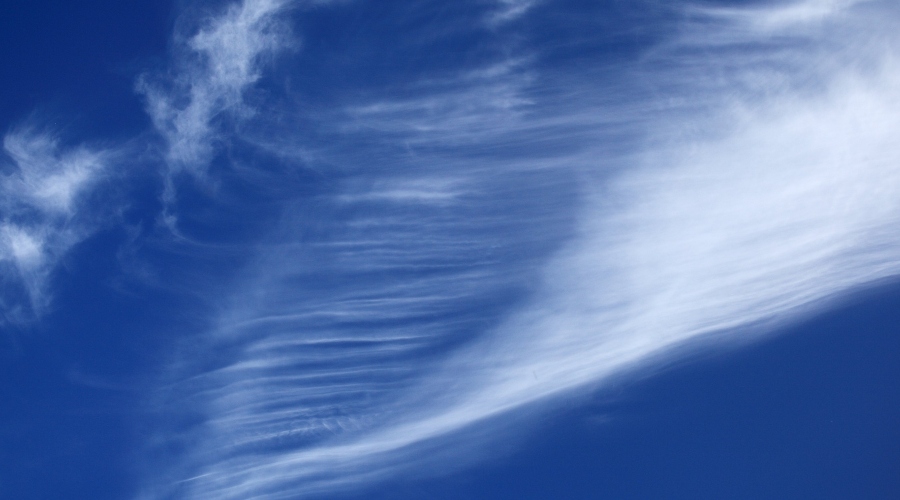
Cirrus are the highest of all clouds and are composed of ice crystals. They have fibrous (hair-like) appearance - see the picture. The sign of the cirrus may be approaching of cold front and therefore change of weather.
Cirrostratus
Cirrostratus are also high clouds and therefore composed of ice crystals and appear as spreading, milky lightening of the sky.
Cirrocumulus
High clouds composed of ice crystals. They are regularly spaced cloudlets or puffs, often rippled.
Cumulonimbus
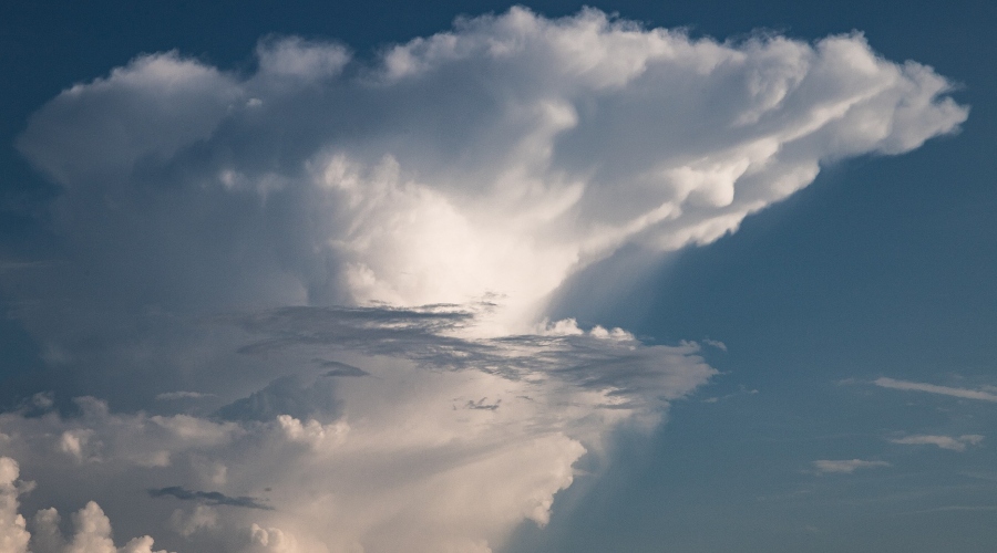
Cumulonimbus, or thunder clouds, are low clouds with anvil-shaped upper part. The tops show a fibrous structure that resembles an anvil. Cumulonimbus clouds are accompanied with heavy downpours and associated hail/thunder.


Readers are further interested